Tsengiwe promotional information
About Tsengiwe
Tsengiwe village is situated in the Sakhisizwe Local Municipality under the Chris Hani District in the Eastern Cape Province, South Africa. It is approximately 16.6 km from Cala town where villagers do their shopping. The timezone in Tsengiwe is Africa/Johannesburg’ Sunrise at 06:49 and Sunset at 17:22. The Latitude. -31.6°, Longitude. 27.65. It is closer to huge Tsomo River from the Drakensberg mountains, a river that does not go dry. The river separates Tsengiwe from Manzimdaka village and Mbenge Village in the East. It is also flanked by Mnxe village from the north and Mbodlane village in the South. Tsengiwe can be easily found on google and further information can be easily accessed. IEC maps can also give a further details about this village. The village does not fall under any Chief but is governed by Headman with six sub-headmen under him.
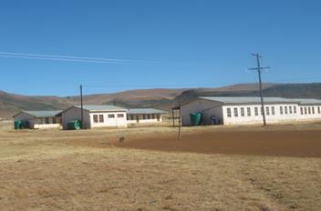
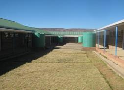
Tsengiwe has two main parts Upper village called Emhlonyaneni and Lower Village called Emandileni. With growth in its population Tsengiwe is further sub-divided into 6 sections called: Each section is governed by sub-headmen- iibhodi. Tsengiwe is flat land flanked by high Mountains on the South West. The sun rises on the East and sets on the West. It has one Health Clinic and two Secondary Schools called: Tsengiwe and Pakamani Junior Secondary Schools. Due to its location at the banks of the Tsomo river, it has potential as a hub for rural development, hence it has attracted collaborations with close by Eastern Cape Institutions of higher Learning called University of Fort Hare; Walter Sisulu University, Rhodes university and Nelson Mandela Metropolitan University around various projects. The leading projects are from University of Fort Hare through the Student Counselling Unit, led by Dr Mlisa a born and bred child from that village. The projects are funded by National Research Foundation and Department of Science and Technology both in Pretoria. The first project is on Sustainability of the Livelihoods at that community (2011- 2013); second on IKS Documentation Centre , operational project funded by DSI and supported by –NIKMAS.
The village is poverty stricken due to vast fields of lands not being fenced and therefore cannot be ploughed as well as droughts. There is also high illiteracy rate as well as high rate of unemployment. The culture of education is lost as even youth is not interested in completing their schooling. This has led to many social pathological problems including the delinquency, truancy, rapid spread of HIV/AIDS, crime (such as theft, murder and rape), drug abuse, alcoholism, and gender inequality and youth suicide including mushrooming teenage pregnancy. According to IEC records found in 2012, Tsengiwe has a very high percentage population of children and young people (< 20 years old) on the one hand, and elderly people on the other. The most economically active segment of the population (20-45 years) comprises only 30% of the population, which is hardly surprising given the lack of local employment opportunity.
The village ineffective governance by the current headman impacts negatively on the development of this village. To manage that villagers came together and formed a Development forum composed of two representatives from each section. This forum is to manage all possible developmental opportunities as means to ensure effective strides towards development and positive transformation in the village. It is this strategy that is supporting current developmental strategies that have seen to formation of cooperatives- primary, secondary and tertiary including a One Stop Centre called Tsengiwe Developmental Centre which is being registered as NGO. The centre will be used as a hub for all developmental strategies and successes in the village. Currently the centre is operating through volunteers who reports at work at 09h00 and leave at 16h00 during the weekdays except Friday where knock off time is 15h00. The volunteers do not get a single centre which is a huge challenge. The centre has an office and small hall for meetings and training. It is electrified but the building which was built by volunteers is full of cracks since it is made from mud and was built by bush builders as there was no money to do better. We thank all volunteers who has supported the centre since 2005 when it started as Masiphile HIV IDS project a name that has been changed in December 2012 to the One Stop Centre.
Traditional Culture
As any village in the Eastern Cape Province, one province which bore the most negative effects of colonization, apartheid and finally Bantustan governance, its traditional cultures are gradually diminishing. For instance, girls would not eat eggs and teenage pregnancy was a most embarrassing factor to any family as compared to it being a fashion today. Children born out of wedlock would never call their mothers ‘mama’ but were grandmother’s children and would say ‘mama’ to grandmother and would call their mothers ‘sisi’. Teenage pregnancy carried a dowry payment unlike today where young fathers take no responsibilities of what used to be called ‘ukwenzakala kwentombi’. As the term ‘ukwenzakala’ means accident, pregnancy before marriage was seen as an accident. The next diminishing cultures is lobola even though girls still get attracted to their chosen partners. Parents can no longer get positively involved in marriage negotiations as before.
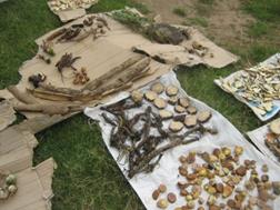
Many cultures are diminishing, ‘proper imbeleko-birth-rites; ukuthomba - as only few families are embarking on this. Some of these challenges could be rightly placed at the door steps of civilization through the western religion and education as its maiden hand. However, certain cultures seem to have sustained all those harsh times such as ukwaluka – boys circumcision. Tsengiwe needs to be congratulated to have kept this ritual and all boys who go to the bush still come back safe and healthy unlike ambush observed from many parts of the eastern Cape Province where to some boys going to the bush is a huge risk that at times actually leave to fatal deaths and irreparable injuries, let alone traumatic emotional scars to them, parents and relatives. However, it must be mentioned that this could also be attributed to integration of traditional and western ways a combination that has kept the culture still good. There are some new introductions not well admired and accepted by many though, best left as they are not to dwell on them here.
Water supply and services
Commercial Developments
Local Municipality Services
Land Use
The tradition is that men would go and leave home to work in the mines and women left ploughing fields and hoeing. Men would come in two seasons: winter to harvest and December to cultivate lands. Currently, land use in and around the village poses a challenge. Agricultural land use is declining and rapid rate of growth of settlement areas, boosted by the provision of housing, roads and services through the Reconstruction and Development Programme, has been at the expense of grazing lands.Crops are farmed on 20% of the land and include maize, wheat and vegetables such as pumpkins, beans and watermelons, sorghum - amazimba. During the interviews with WRC (Water Research Commision), Umvoto and University of Fort hare in 2012 the villagers informed us that the the area of land used for crops and grazing decreased during the period 1988–98 partly because of land/soil and vegetation degradation. Other factors include the droughts of the mid-1980s and early 1990s as well as violence and stock theft in the communal areas, increased production costs, lack of support for communal farmers and the collapse of agricultural infrastructure, especially the removal of fencing post-1994. As such, currently the fields are unfenced, grazing lands and at the mercy of soil erosion. A large area of arable land is therefore is no longer in use despite the fact that some of these fields are at the banks of the perennial Tsomo River.
Since 2005, families with land on the banks of the river have repeatedly asked for help with irrigation and fencing of the fields from the provincial Department of Agriculture and from the Faculty of Agriculture at the University of Fort Hare, without success. Crop production and marketing could immediately be piloted on this land should it be fenced. There are families willing to lease their lands for sub-division into plots which could be used for development purposes. The village used to plough with oxen but tractors and donkeys are now employed. A government project called Umngcunube is reinstating vegetable gardens and community members are encouraged to use their gardens. There are two schools but neither has a vegetable garden. This is a great worry to the community, because agriculture is taught only in theory and children gain no practical experience at school level. The villagers mostly farm on stock farming, including beef cattle, sheep and goats. Almost 30% of this land has been invaded by the shrub called Ilapesi (Euryopspyroides) and grasslands suitable for grazing are being further limited by allocations to housing and degraded through erosion. University of Fort hare is currently conducted a research study on the effects of this shrub on grazing land. Such challenges pose serious concerns as affect food security.